YSS FOR
VIKING STUDIES
Runstenar
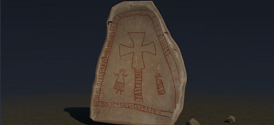
Runstenar (Runestones) is a digital map of Viking Age Sweden with access to 3D models of 17 runestones from all over the country.
It is an interactive map designed to give members, as well as anyone who is generally interested in the Viking Age, the opportunity to see the archaeological evidence as if they were standing in front of it.
Significance
Each runestone was visited by Josefine as part of her research on women in Viking Age society. Many of the runestones name women: as people who commissioned them, as heirs, as the people they remember, and in one case as a woman who made the runestone. Each runestone carries a unique significance in the pursuit of uncovering what women's lives were like back then.

What's included?
Each stone is pinned to its real-life location on a 2D map of Sweden. Click on any stone and open a 3D image of it, where you can spin it around and study it, read its full inscription, in runes and in transliteration, with an English translation and a description of what it records and why it is significant.

Additional information available:
Each runestone also lists beneath it its exact coordinates (in case you ever decide to visit it in person), its approximate dating, size (length and width), and the rune row it is carved in.